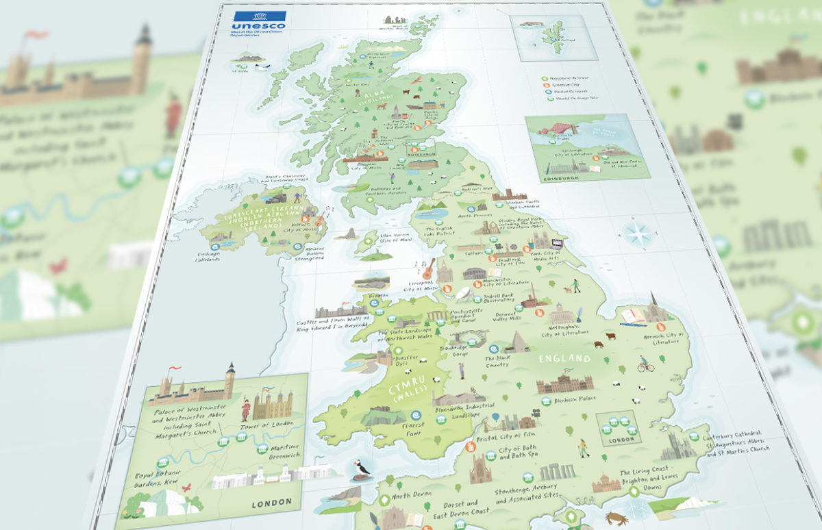
This resource focuses on an illustrated map, leaflet and website detailing the 58 sites in the UK which UNESCO has honoured with status Biosphere Reserve, Creative City, Global Geopark or World Heritage Site. This document can be studied from many different points of view and levels. We chose to target A2 students with a dual … Continue reading “Beautiful Britain: Discover the U.K.’s UNESCO sites”

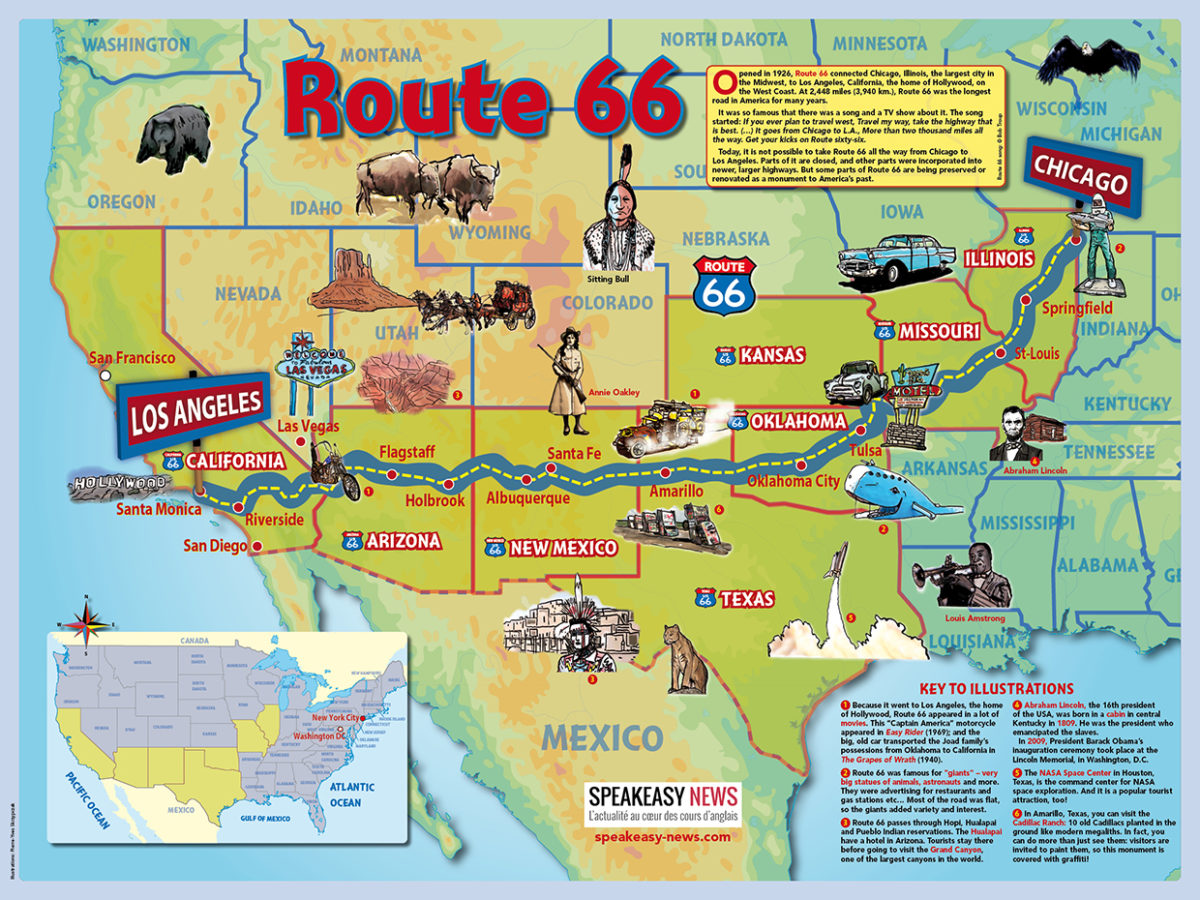
To accompany Shine Bright 1re Advanced File 4: “On the Road, you can download this Route 66 poster illustrated with lots of interesting landmarks to be found along the Mother Road. To download the poster, just click on the link below.

Celebrate the Mother Road festival in September with this illustrated Route 66 poster has lots of interesting landmarks to be found along “American’s Main Street”. You can download it for class use. To download the poster, just click on the link below.

It is one of the greatest mysteries of our time — why is New Zealand always being left off world maps? A new video tackles the issue. In a 2.5 minute video posted to Facebook around 10am on Wednesday 2 May 2018, New Zealand has launched a tourism campaign exploring this question that has bothered … Continue reading “New Zealand, Where Are You?”

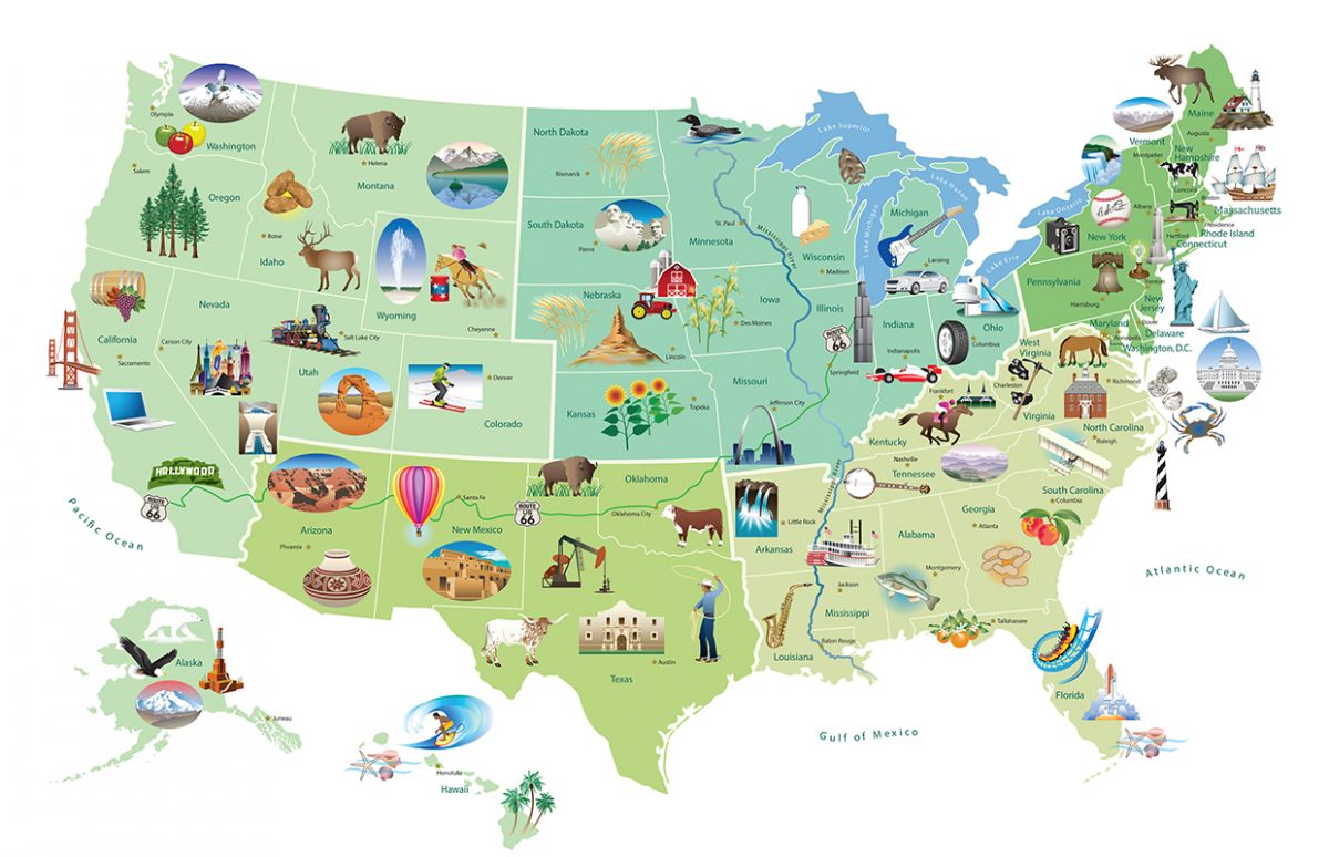
This illustrated map produced by the U.S. State Department provides a visual presentation of U.S. states associated to landmarks and industry. It could be used at various levels, depending on what is to be achieved by the students. We have provided teaching suggestions and a worksheet for an A2 level. This is a good opportunity … Continue reading “U.S. Landmarks and Icons Map”


