


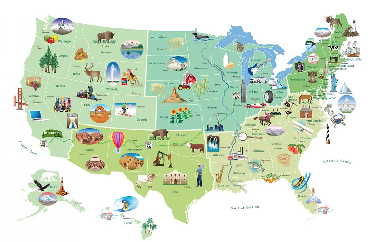
This illustrated map produced by the U.S. State Department provides a visual presentation of U.S. states associated to landmarks and industry. It could be used at various levels, depending on what is to be achieved by the students. We have provided teaching suggestions and a worksheet for an A2 level. This is a good opportunity for group work, with a focus on what is to be learnt by all students, while letting them choose the state(s) they want to work on in the final activity.
Vocabulary and structures
- in the west/western, Midwest/Midwestern...
- famous for, located in
- landmarks
- sunflowers, rubber industry, dairy products...
- passive voice (are sculpted, were persecuted, was given...)
- relative pronouns.
Pronunciation
- State names, with particular attention to stress (eg. Florida, Kentucky, Texas, Vermont).
- Arkansas: / ˈɑː kən sɔ:/
Copyright(s) :
Eve Steccati/Embassy of the U.S.A. Bureau of information programmes
Download resources :
Please connect with your Nathan Enseignant account (or register for free) to download files for free:


Notion(s) culturelle(s) :
"Des repères géographiques, historiques et culturels"